Do you have any questions? Submit your request by clicking this link.


Find out what functionality you will be able to use after downloading the mobile app.
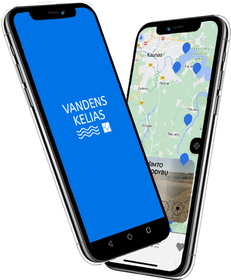
An interactive Kaunas – Augustow waterway map is integrated into the app.
Convenient, simple and fast mobile app download from Google Play and App Store.
The mobile app features heritage and attractions while sailing on and around the Nemunas and Augustow canal.

The mobile app is prepared in three languages – Lithuanian, English and Polish.
The app contains links to places of interest, with the help of which you can reach the place you want to visit via Google or Apple Maps.
In the mobile app, you will be able to conveniently mark which objects you plan to visit and which ones you have already visited.
Length of waterway (km)
Cultural heritage sites to visit
Waterway partners
Duration of the shipping (tourism) season (in days)
Basic information about the Waterway project – Kaunas – Augustow waterway route, cultural heritage and places of interest.
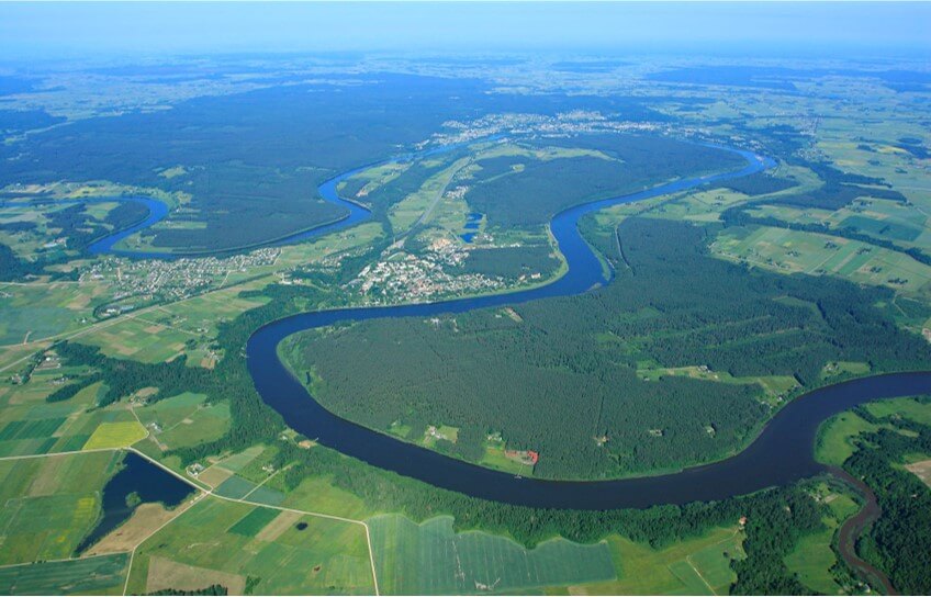
Travel and trade along the Nemunas River has been going on for millennia. It is surrounded by legends and secrets of the Amber Road trade and other pleasant surprises. Well, the Augustow canal, which connects the Nemunas and the Vistula rivers, was built almost 200 years ago (1823 – 1839).
Today, it is the most popular international tourist route from Augustow or Druskininkai through Merkinė, Alytus to Prienai, Birštonas or Kaunas. It can be sailed for 1-2-3 days or for a whole week in selected sections of a dozen kilometers or completely.
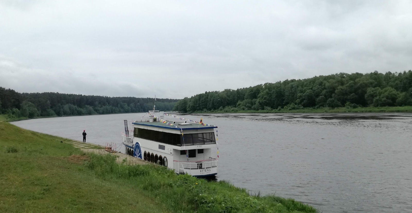
It is also an opportunity to escape from the hustle for a few hours and indulge in the flow of the river with a group of friends or colleagues in ships, boats or kayaks.
More and more services for tourists are created and offered by the active water tourism business and public sector in all three countries. It is expected that after the appropriate time it will be possible to sail freely through and from the country of Belarus again, and for now we will choose the Lithuanian and Polish sections of this road, combining sailings with bus or car crossings.
The Augustow canal is a unique international object of technical and cultural heritage, nature and landscape. There are more than 25 larger and several smaller cultural heritage sites on and near the canal, as well as other attractions.
The canal connects the Nemunas and the Vistula rivers, flowing 44.85 km through valleys and artificially excavated tracks, 21.30 km through lakes and 35.05 km along the canalized Neta and Juodoji Ančia (pl. Charna Hancia) riverbeds.
Together with the buildings and facilities of the complex, it is included in the list of cultural heritage objects and is considered a historical monument. The aim is to add the canal to the UNESCO World Cultural Heritage list.
Formally, the canal is considered a Class Ia waterway of regional importance.
The total length of the canal is 101.2 km, of which: 80 km runs on the Polish side, 3.4 km along the Polish-Belarusian border line, and 17.8 km on the Belarusian side – to the Nemunas inflow.
It flows through Augustow and Knyszyn forests, Wigri national and Suwalki and Biebrza landscape parks.
Nemunas is the longest river in Lithuania. Its total length is 937 km, 475 km on the territory of Lithuania. Its section from Druskininkai to Kaunas (188 km) is called the upstream.
Vessels with a draft greater than 0.75 m can sail in Nemunas (in 2022) in the lower reaches of the Nemunas – from Kaunas to the Baltic Sea and in separate sections in the upper reaches: Birštonas / Prienai – Kaunas and Druskininkai – Liškiava. In other sections, it is recommended to sail only with smaller draft boats, kayaks, etc.
The Augustow canal flows into Nemunas in Belarus, below Gardinas (pl. Grodno); later again the border, the corresponding restrictions. The border of Lithuania and Belarus runs along the river for 17.3 km – in this section there is the Bugieda slip (for the entry or exit of border boats from the river), the left tributary – Baltoji Ančia. At the end of the border section, coming from the Augustow canal (from Gardinas), until 2021 we were greeted by Pervalka (Privalka / BY), then the seasonal river border checkpoints (customs) of Švendubrė (LT) on the other side. It is expected that this will be the case in the near future as well.
When traveling from Kapčiamiestis by kayak on the Baltoji Ančia river, after entering the Nemunas you must stick to the left bank of the river (on the right side is the territory of Belarus – it is forbidden to enter or leave it, especially without a valid visa).
A slip has been installed at Švendubrė point. There are fixed piers in Druskininkai, Alytus and Birštonas, and a dozen mobile ones in these and other areas.
From Švendubrė, the journey continues more freely.
The tourist navigation map, which shows the map of the waterway (fairway) connecting Lithuania and Poland via the Augustow canal and the Nemunas, can be found by downloading the “Vandens kelias“ (Waterway) application or by clicking on this link. The objects around the waterway are displayed in the “Vandens kelias“ (Waterway) application.
After launching the mobile app, you will see the main screen where you can choose:
(a) if you have an account, register with ArcGIS Online;
b) the same if you have a company account;
c) if you do not have an account, you skip registration (in this case, you will only be able to work in preview mode, but it is enough to use interactive maps).
When you click Skip Sign in you will see something like this image. You need to find the map you want. To do this, enter a keyword (at least one
word of the map names below. You choose the one that suits you from the list provided, let’s say in this case “Bad example”.
Tap the icon provided and the full map view will open.
You will see a map view with various information on it according to individual topics.
The app is simple. At the top of the menu, we can see the following icons: Viewing, enabling, disabling maps, information topics (layers); search, opening the tools menu.
You can also see the accuracy of your device’s GPS receiver, in this case 5.3m. You can pan the map with one finger, zoom in or out, or rotate with two fingers. This allows you to see a compass arrow on the screen, which when pressed, orients the image in a north direction, and zooms the map according to your location. When you click this tool, you will see a round flashing dot on the map that shows where you are. When you move (let’s say you’re sailing), the map moves according to your location.
On the map, you will see waterway markings, water depths, the arrangement of buoys (buoys), the areas of built and constructed buoys and their axial lines, etc. In order not to overload the map, turn on the most necessary thematic layers at the time.
While traveling in Nemunas, we invite you to get to know the ethnographic village of Švendubrė, the “Devil” stone, the Raigardas valley, the house-museum of the composer and artist M.K. Čiurlionis, who visited Druskininkai and the surrounding area, churches, sanatoriums, spas, parks, other objects, and the Leipalingis manor homestead located further on. Later – the Liškiava outcrop, the mound, the church, the bell tower and the former monastery. Dzūkija National Park, the Utieka Geomorphological Reserve, the outcrop, the Panara Chapel, are on the way. The famous Merkinė mound, observation tower, church, local history museum, Janoniai stones.
As you sail further, you can see the Great Dzūkija stone, the crosses of Klepočiai village, the mounds of Dirmiškiai and Papėčiai and Bambininkai, the Baltasodis botanical reserve, the churches of Krikštoniai and Nemunaitis, the outcrop of limestone tuffs of Nemunaitis. On the way, the mounds of Radžiūnai and Alytus, the Alovės outcrop, the Poteroniai mound in the distance; Vidzgiris Botanical Reserve. In Alytus, let’s also visit the museum of local history, an amusement park, churches, the former railway station, the highest pedestrian bridge over the Nemunas and other objects.
Outside of Alytus, you will find the Rumboniai church and mound, the Bundoriai mound, the Panemunininkai cliff, the Punia mound and church, and the coolness of the heath,the Oak Alley; Pelėsiškiai mound, Nemajūnai church and mound, Siponiai manor and outcrop; Margarava and Šilėnai mounds.
In the vicinity of Balbieriškis there is a manor park, mineral springs and an outcrop, further on is the Naravai mound and the Kemuvių outcrop, the Nemunas loop regional park. In Prienai, we will visit the former paper manufacture (workshops), the museum of local history, a church, a mound, a monument to the King Vytenis, and then the Žarija mounds.
In Birštonas, let’s visit sanatoriums, SPAs, a mound and a monument to King Vytautas the Great, a church, parks and other objects, and ride the largest network of bicycle paths. Paverkniai and Pašventupis mounds, Pociūnai airfield, Daukšiagirė manor await us further on.
Approaching Kaunas – Pelekoniai, Gegužinis, Bačkininkėliai, Lašiniai, Dovainoniai, Samylos, Pakalniškiai, Vieškūnai mounds, Junipers valley, Strėva and Dovainoniai outcrops, Mergakalnis, Rumšiškės Ethnographic Museum. In Kaunas, next to the pier, there is the Pažaislis Monastery and many other interesting objects.
More information about attractions and services can be found in other departments and in tourist information centers (TIC) or visitor service centers (LAC / en. VIC).
Do you have any questions? Submit your request by clicking this link.
We share with you the development news of the “Water way” project.
 About project
 About project
If you have any questions, fill out the inquiry form, send us an e-mail. email or call.
Association Nemunas Euroregion
Vytauto st. 28, Marijampolė, LT-68296